

Search for Your Deed
Welcome to the Hampden County Registry of Deeds
The Hampden County Registry of Deeds is committed to providing the public with efficient, courteous service and easy, reliable access to its records. Our district maintains land records for the following 23 cities/towns:
Agawam • Blandford • Brimfield • Chester • Chicopee • East Longmeadow • Granville • Hampden • Holland • Holyoke • Longmeadow • Ludlow • Monson • Montgomery • Palmer • Russell • Southwick • Springfield • Tolland • Wales • Westfield • West Springfield • Wilbraham
Search Site
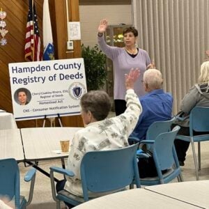
Consumer Notification System
Consumer Notification System
Customer service is our top priority at the Hampden County Registry of Deeds. The Hampden County Registry of Deeds is proud to offer a free notification tool, which alerts homeowners when a new document is recorded in their name. If you own real estate in one of the 23 cities and towns in Hampden County, you can subscribe to this service, free of charge.
Please note: Our notification system queries records by name and not address. Because of this, you may receive alerts about other people with the same name. If you have any questions about this service, please contact the Registry. If you believe a document has been recorded fraudulently in your name, please contact the Hampden County Registry of Deeds at 413-755-1722, and one of our customer service specialists will look up the record for you. All victims of fraud should contact local law enforcement authorities.
Quick Information
Website Search Instructions
Click Image To View Search Instructions


About Us
Secretary of the Commonwealth

William F. Galvin
Secretary of the Commonwealth
Citizen Information Service
One Ashburton Place, Room 1611
Boston, MA 02108-1512
Tel: (617) 727-7030
Toll Free: 1 (800) 392-6090
Homestead Protections
Protect Your Home Q & A (PDF)
in English
in Spanish
in Brazilian Portuguese
Declaration of Homestead Forms
"Helping You is Our Top Priority!"
Consumer Alerts
Hampden County City/Town Websites
Click on the desired city or town to visit their webpage.
Agawam | Blandford | Brimfield | Chester | Chicopee | East Longmeadow | Granville | Hampden | Holland | Holyoke | Longmeadow | Ludlow | Monson | Montgomery | Palmer | Russell | Southwick | Springfield | Tolland | Wales | West Springfield | Westfield | Wilbraham
Directions
Using This Site
Vision Impaired Assistance
This website has been created to facilitate use by vision impaired persons. Where possible we use code friendly for screen readers and give users the ability to change or increase the text size, and use stylesheets so that visitors can easily change the colors of the site using their system preferences. Please use the tools provided on the right side of every page.